
Satellite positioning interference at different flight altitudes examined with a prototype device – results already expected before Midsummer
3.6.2026 06:30:00 EEST | Maanmittauslaitos | Press release
Researchers installed a satellite positioning interference testing device on an electric aircraft in Lappeenranta. Preliminary results on interference and preparedness for it at different flight altitudes are already expected before Midsummer.
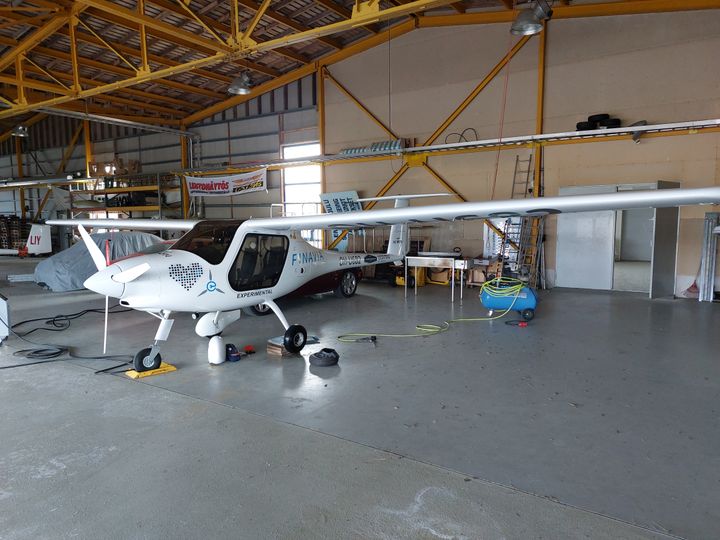
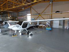
Finnish Geospatial Research Institute FGI at the National Land Survey of Finland has started cooperation with LUT University, in which a prototype developed by FGI of a device that detects satellite positioning interference is installed on an electric aircraft used by LUT to investigate electric aviation. The aircraft is operated from Lappeenranta Airport.
The aim of the researched conducted by the Finnish Geospatial Research Institute FGI at the National Land Survey of Finland is to develop and test the detection and prevention of satellite positioning interference, especially from the point of view of air traffic. Data is collected on the vertical profile of positioning interference, that is, at what altitude the interference disrupts air traffic. In addition, the amount of interference in different areas around Lappeenranta is mapped, along with how flying over land or sea affects the interference.
“We are developing new equipment as part of an EU-funded research project to combat satellite positioning interference, and we have high expectations for the measurements currently being carried out in Eastern Finland,” says Senior Research Scientist Mika Saajasto from the Finnish Geospatial Research Institute FGI at the National Land Survey of Finland.
Aiming to develop backup positioning systems and protection
Satellite positioning interference, or GNSS interference, in the Finnish territory has increased significantly since 2022. This interference disrupts air and sea traffic and rescue services, as well as stock exchanges and telecommunications networks.
The aim of the research is to find solutions that can reduce the effects of interference and thus improve the reliability and safety of positioning.
“Geospatial data is a critical part of overall security and a prerequisite for functioning services, but the current means to counter satellite positioning interference in Finland are limited. To ensure reliable positioning, research is needed to develop satellite positioning backup systems and protection, and we are responding to this need with our research,” Saajasto says.
Results expected before Midsummer
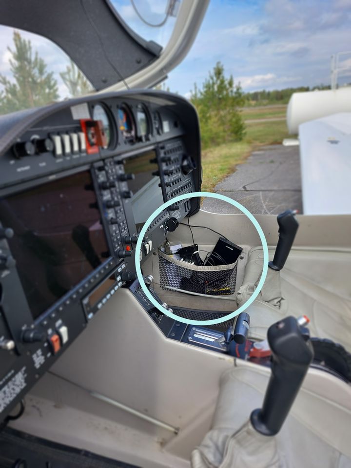
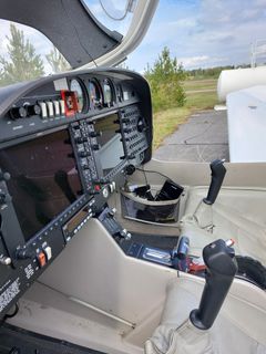
The prototype equipment measuring satellite positioning interference consists of a commercial GNSS receiver and antenna, as well as a minicomputer that analyses the measurements produced by the receiver using an interference detection algorithm developed by the Finnish Geospatial Research Institute and produces a report of them.
“The intention is that preliminary data would be available for examination in early summer. Going through and analysing the data will take time, but we hope to get preliminary results on the amount of interference at different flight altitudes already by Midsummer,” says Saajasto.
In the future, the Finnish Geospatial Research Institute will develop the equipment so that it will be able to warn of any GNSS interference it detects in real time.
Research cooperation advances the measurement of positioning interference
GNSS interference measurements are conducted in Lappeenranta through cooperation between several operators. The Finnish Geospatial Research Institute is developing an interference detection algorithm and equipment. The prototype of the equipment has been installed on an electric aircraft that LUT uses to explore the technology and opportunities of electric aviation. The aircraft is flown in Lappeenranta by volunteers from the local aviation club.
“This cooperation is an excellent opportunity for us, as Lappeenranta, which is located near the eastern border, is a particularly interesting target for GNSS interference research. We were able to install a prototype of the equipment on an aircraft flying in this area and, at the same time, we have the chance to participate in future air traffic research,” Saajasto sums up.
____________________________________________________
Resilient positioning in Eastern Finland reserach project develops real-time identification of intentional GNSS jamming and how to mitigate its effects especially in aerial imaging and air traffic. Correcting aerial imagery affected by jamming will also be studied and recommendations will be provided for how to minimize the effect of jamming on aerial imagery. The project will bring benefits for critical players dependent on GNSS.
Co-funded by the EU, the project is financed by the Economic Development Centre of Eastern Finland through ERDF funding.

Contacts
Mika Saajasto, Senior Researcher, Finnish Geospatial Research Institute FGI at the National Land Survey of Finland, tel. +358 46 923 7174, firstname.lastname@nls.fi
Sanna Kaasalainen, Professor, Finnish Geospatial Research Institute FGI at the National Land Survey of Finland, tel. +358 29 531 4760, firstname.lastname@nls.fi
Images

The National Land Survey helps to ensure the functioning of Finnish society. We provide data and services to secure ownership and facilitate the use of spatial data. Our world-class scientific research advances the spatial data field. We are one of the authorities that maintain Finland’s basic registers and an internationally recognised research institution.
Alternative languages
Subscribe to releases from Maanmittauslaitos
Subscribe to all the latest releases from Maanmittauslaitos by registering your e-mail address below. You can unsubscribe at any time.
Latest releases from Maanmittauslaitos
Kesän juttuaiheita Maanmittauslaitoksesta23.7.2026 07:50:00 EEST | Tiedote
Kesällä suomalaisia kiinnostavat mökkeilyyn liittyvät kysymykset: mistä näkee tontin rajat, miten voi lunastaa rantaan ilmestyneen vesijättömaan ja kenellä on oikeus kulkea mökkitiellä. Ajankohtaisia aiheita ovat myös sienestys ja marjastus sekä läpi kesän jatkuvat Maanmittauslaitoksen ilmakuvauslennot. Kokosimme alle kiinnostavimmat kesätärpit ja aiheet, joista kansalaiset kysyvät nyt erityisen paljon.
Nallekarkit apuna vierasviljojen tunnistamisessa - digitaalinen ratkaisu tehostaa puhdaskauran tuotantoa21.7.2026 07:50:00 EEST | Tiedote
Maanmittauslaitoksen Paikkatietokeskus FGI on mukana kehittämässä uutta digitaalista ratkaisua vierasviljojen tunnistamiseen ja poistamiseen pelloilta. Menetelmä yhdistää droonikuvauksen, tekoälyn ja mobiilipohjaisen navigoinnin. Sen testauksessa käytettiin keväällä yllättävää kohdetta: nallekarkkeja. Heinäkuun alussa Etelä-Pohjanmaalla järjestetyissä varsinaisissa peltokokeissa saatiin rohkaisevia tuloksia.
Forskare inom satellitpositionering samlas i Finland för att lösa positioneringsutmaningar – Europeiska rymdorganisationens forskningsevenemang i Esbo startar 13.7.9.7.2026 10:43:29 EEST | Pressmeddelande
Europeiska rymdorganisationen och Europeiska kommissionens gemensamma forskningscentrum arrangerar ett internationellt forskningsevenemang om satellitpositionering i Finland i juli. Forskare från Lantmäteriverkets Geodatacentral FGI deltar i evenemanget som fokuserar på teknologi för positionering, navigering och tidsbestämning, satellitsystemens framtid och bekämpning av hot.
Satelliittipaikannuksen tutkijat kokoontuvat Suomeen ratkomaan paikannuksen haasteita – Euroopan avaruusjärjestön tutkijatapahtuma Espoossa käynnistyy 13.7.9.7.2026 10:43:29 EEST | Tiedote
Euroopan avaruusjärjestö ja Euroopan komission yhteinen tutkimuskeskus järjestävät kansainvälisen tutkijatapahtuman Suomessa heinäkuussa. Maanmittauslaitoksen Paikkatietokeskus FGI:n tutkijat osallistuvat tapahtumaan, joka keskittyy paikannuksen, navigoinnin ja ajanmäärityksen teknologioihin, satelliittijärjestelmien tulevaisuuteen ja uhkien torjuntaan.
Satellite positioning researchers will meet in Finland to solve positioning challenges – the European Space Agency’s research event in Espoo begins on 13 July9.7.2026 10:43:29 EEST | Press release
In July, the European Space Agency and the European Commission's Joint Research Centre are holding an international research event in Finland. Researchers from the National Land Survey of Finland’s Geospatial Research Institute (FGI) will participate in this event, which focuses on satellite positioning, navigation and timing technologies, the future of global navigation satellite system (GNSS), and threat prevention.
In our pressroom you can read all our latest releases, find our press contacts, images, documents and other relevant information about us.
Visit our pressroom