
Satellite positioning researchers will meet in Finland to solve positioning challenges – the European Space Agency’s research event in Espoo begins on 13 July
9.7.2026 10:43:29 EEST | Maanmittauslaitos | Press release
In July, the European Space Agency and the European Commission's Joint Research Centre are holding an international research event in Finland. Researchers from the National Land Survey of Finland’s Geospatial Research Institute (FGI) will participate in this event, which focuses on satellite positioning, navigation and timing technologies, the future of global navigation satellite system (GNSS), and threat prevention.
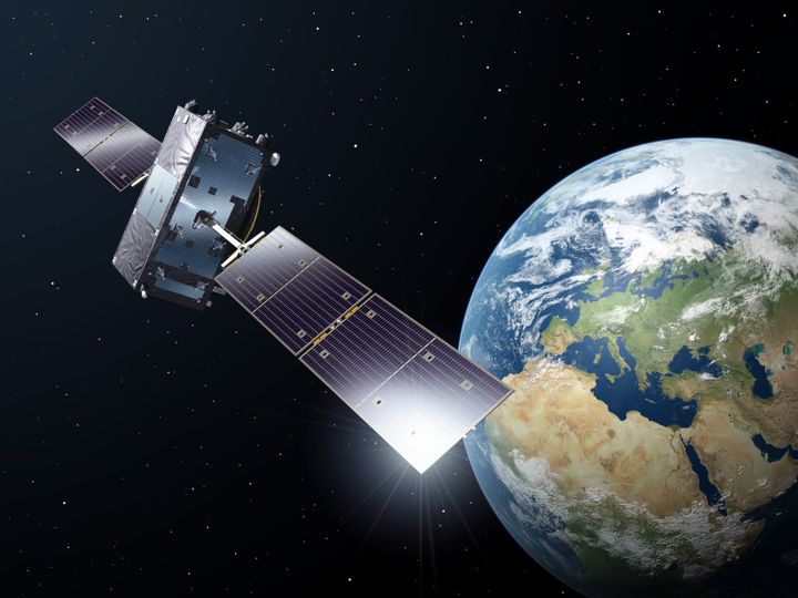
The ESA/JRC International Summerschool on GNSS will be held in Espoo on 13–24 July 2026. It is an international event for satellite positioning researchers, organised by the European Space Agency (ESA) and the European Commission’s Joint Research Centre (JRC). The event focuses on GNSS technology and the future, threats to satellite systems and their countermeasures, and brainstorming and development of products and services that use GNSS.
“Satellite positioning is a very topical field of research in which a lot is happening in Europe. In Finland, we conduct high-quality research, and within the business and innovation activities in the field, we have plenty of exploitable opportunities,” says Minister of Economic Affairs Sakari Puisto.
At the Summerschool event, internationally renowned scientists and specialists will give talks, alongside practical exercises and lab work. A limited number of 100 participants have been selected this year, a record in candidate submission and participation out of which three researchers from the National Land Survey of Finland’s Geospatial Research Institute (FGI) will participate.
“At the Finnish Geospatial Research Institute FGI, we carry out extensive research on satellite positioning with funding from the European Space Agency and participate in ESA space programs and their management. This Summerschool event in Finland is an opportunity for our researchers to be part of an international network of researchers,” says Professor Sanna Kaasalainen from the Finnish Geospatial Research Institute (FGI).
Close cooperation throughout Europe in the development of satellite systems
The European Space Agency is currently developing and testing solutions to counter satellite positioning interference with two new satellites. In March, the Celeste satellites, which are built in Europe, were launched to a Low Earth Orbit (LEO) around the globe. Researchers at the Finnish Geospatial Research Institute (FGI) have joined the Celeste project by assessing the performance of low-orbit satellites in the Arctic.
“In Finland, we handle the fundamentals of positioning and support the development of the European Galileo positioning system. Now, in the Celeste project, we are helping to improve the European system further. In the current security environment, it is more important than ever to focus on European cooperation to maintain and develop our satellite systems,” says Kaasalainen.
Functioning satellite positioning creates conditions for innovation and growth
In addition to technology and security, new business is also an emphasis of the Summerschool event.
“In Finland, there’s a lot of business activity in the satellite positioning field. Maintaining and developing a reliable and secure positioning system is also important, as it adds to the conditions for new innovations that use positioning and, through them, growth,” says Kaasalainen.
Contacts
Director of Navigation and Positioning Sanna Kaasalainen, Finnish Geospatial Research Institute FGI, +358 50 369 6806, firstname.lastname@nls.fi
The National Land Survey of Finland’s media service phone number is +358 29 531 5050 (weekdays 9 am–3 pm), email address viestinta@maanmittauslaitos.fi
Images
Links
The National Land Survey helps to ensure the functioning of Finnish society. We provide data and services to secure ownership and facilitate the use of spatial data. Our world-class scientific research advances the spatial data field. We are one of the authorities that maintain Finland’s basic registers and an internationally recognised research institution.
Alternative languages
- FIN: Satelliittipaikannuksen tutkijat kokoontuvat Suomeen ratkomaan paikannuksen haasteita – Euroopan avaruusjärjestön tutkijatapahtuma Espoossa käynnistyy 13.7.
- SWE: Forskare inom satellitpositionering samlas i Finland för att lösa positioneringsutmaningar – Europeiska rymdorganisationens forskningsevenemang i Esbo startar 13.7.
Subscribe to releases from Maanmittauslaitos
Subscribe to all the latest releases from Maanmittauslaitos by registering your e-mail address below. You can unsubscribe at any time.
Latest releases from Maanmittauslaitos
Lisääntyneitä syystulvia ja sulaa kesken talven – Suomen joissa näkyy muutos, jonka seuraaminen auttaa varautumaan tulevaan1.10.2026 07:00:00 EEST | Tiedote
Tänä syksynä monet pohjoisen joet ovat nousseet lähelle tulvakorkeuksia, jopa korkeammalle kuin koskaan aiemmin. Kesällä puolestaan eri puolilla Suomea ihmeteltiin, mitä tehdä laitureille, joiden alta vedenpinta oli paennut. Tutkijat Turun yliopistosta ja Maanmittauslaitoksen Paikkatietokeskus FGI:stä palasivat juuri Oulankajoelta maastomittauksista, jotka kertovat jokien muutoksesta.
Nelostien Kirri-Tikkakoski-moottoritiehankkeen lunastuskorvaukset tulevat maksuun29.9.2026 07:27:02 EEST | Tiedote
Kirri-Tikkakoski-moottoritiehankkeen lunastuskorvauksista maanomistajille päätetään 1.10.2026 Jyväskylässä, kun Maanmittauslaitoksen vetämä lunastustoimikunta vie päätökseen maantietoimituksen. Noin 15 km pitkä uusi moottoritie avattiin liikennekäyttöön joulukuussa 2021.
Hirvivahingoista 55 miljoonan vuosittaiset tappiot metsänomistajille – löytyykö robotiikasta apu vahinkojen vähentämiseen?14.9.2026 07:00:00 EEST | Tiedote
Puiden taimet maistuvat hirville, mutta syönninestoaineen levittäminen käsin on hidasta ja työlästä. Nyt tutkitaan, voisivatko droonit korvata ihmistyön ruiskuttamalla ainetta tekoälyn avulla tunnistamiinsa taimiin. Metsäkeskuksen vetämässä tutkimushankkeessa mukana ovat Maanmittauslaitoksen Paikkatietokeskus FGI, Luonnonvarakeskus ja Riistakeskus.
Statistik: I huvudstadsregionen råder köparens marknad – huspriserna sjönk27.8.2026 07:45:00 EEST | Pressmeddelande
Medianpriserna för egnahemshus sjönk i Esbo, Helsingfors och Vanda. I Birkala fick man betala nästan 50 000 euro mer för ett hus än i fjol. Handelsvolymen av stugor med egen strand ökade med nästan 9 procent. I glesbygder ökade tomtköpen med 8,7 procent, med den största ökningen i Nyland. Lantmäteriverket sammanställde köpeskillingsregistrets uppgifter om köpeskillingarna och antalen köp för egnahemshus och sommarstugor från ingången av januari 2026 till utgången av juli.
Tilasto: Pääkaupunkiseudulla ostajan markkinat, talojen hinnat laskivat27.8.2026 07:45:00 EEST | Tiedote
Omakotitalojen mediaanihinnat laskivat Espoossa, Helsingissä ja Vantaalla. Pirkkalassa talosta joutui maksamaan lähes 50 000 euroa viime vuotta enemmän. Rantamökkien kauppamäärä kasvoi lähes 9 prosenttia. Haja-asutusalueella tonttikauppoja tehtiin 8,7 prosenttia enemmän, eniten Uudellamaalla. Maanmittauslaitos kokosi kiinteistöjen kauppahintarekisteristä omakotitalojen ja mökkien kauppahinnat ja kauppojen lukumäärät vuoden 2026 alusta heinäkuun loppuun.
In our pressroom you can read all our latest releases, find our press contacts, images, documents and other relevant information about us.
Visit our pressroom