
New topographic data production tool to be based on open source code
22.9.2020 14:08:05 EEST | Maanmittauslaitos | Press release
“The open source platform helps us to develop the system in broad cooperation with companies and other public organisations. The NLS has been one of the first public organisations to give open access to their data, and we will also continue on this path in terms of app development”, said Jani Kylmäaho, director of development and digitalisation.
With this decision, the NLS is also promoting the goal set in the Government programme to give open source code a priority in public data systems.
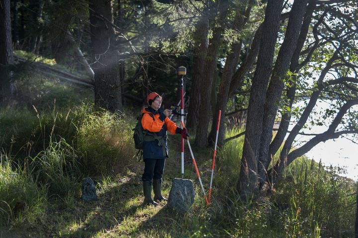
This system modernisation is very significant for the NLS. The new system will collect and update data in the National Topographic Database and produce general map products. New requirements for the production of topographic data include the processing of 3D data, the lifecycle management of topographic objects and the use of analytics tools that make data updates more effective. It would not be cost-effective to add these features to the current system.
Flexibly and effectively towards the new system
The NLS aims to build a supplier-independent technological environment as the platform of the new topographic data production system. The goal is to build a modular system architecture. This means that the NLS can select the most optimal tool for each work phase. Technological solutions can also be changed or entered into bidding processes flexibly. The system architecture may include both open source components and closed solutions.
“When we were planning the system update, we noticed that we could effectively fulfil the current needs of our topographic data production process using an open source solution. According to our strategy, we work actively in networks and as part of different ecosystems. This system solution also supports this goal,” Kylmäaho said.
During the first phase, the NLS will prepare a procurement and deployment plan for the new topographic data production system.
Contacts
Jani Kylmäaho, director of development and digitalisation, +358 40 489 0307, jani.kylmaaho@nls.fi
Questions related to topographic data production:
Juha Vilhomaa, director, +358 40 500 3905, juha.vilhomaa@nls.f
Cooperation with system suppliers:
Kimmo Perttilä, senior specialist, +358 40 521 9495, kimmo.perttila@nls.fi
Images

About Maanmittauslaitos
 Maanmittauslaitos
PL 84 (Opastinsilta 12C)
00521 HELSINKI
029 530 1100 (Vaihde)https://www.maanmittauslaitos.fi/
We perform cadastral surveys, maintain information about properties and dwellings, handle registrations of title and mortgages, produce map data and promote the research of spatial data.
National Land Survey of Finland
Subscribe to releases from Maanmittauslaitos
Subscribe to all the latest releases from Maanmittauslaitos by registering your e-mail address below. You can unsubscribe at any time.
Latest releases from Maanmittauslaitos
Kesän juttuaiheita Maanmittauslaitoksesta23.7.2026 07:50:00 EEST | Tiedote
Kesällä suomalaisia kiinnostavat mökkeilyyn liittyvät kysymykset: mistä näkee tontin rajat, miten voi lunastaa rantaan ilmestyneen vesijättömaan ja kenellä on oikeus kulkea mökkitiellä. Ajankohtaisia aiheita ovat myös sienestys ja marjastus sekä läpi kesän jatkuvat Maanmittauslaitoksen ilmakuvauslennot. Kokosimme alle kiinnostavimmat kesätärpit ja aiheet, joista kansalaiset kysyvät nyt erityisen paljon.
Nallekarkit apuna vierasviljojen tunnistamisessa - digitaalinen ratkaisu tehostaa puhdaskauran tuotantoa21.7.2026 07:50:00 EEST | Tiedote
Maanmittauslaitoksen Paikkatietokeskus FGI on mukana kehittämässä uutta digitaalista ratkaisua vierasviljojen tunnistamiseen ja poistamiseen pelloilta. Menetelmä yhdistää droonikuvauksen, tekoälyn ja mobiilipohjaisen navigoinnin. Sen testauksessa käytettiin keväällä yllättävää kohdetta: nallekarkkeja. Heinäkuun alussa Etelä-Pohjanmaalla järjestetyissä varsinaisissa peltokokeissa saatiin rohkaisevia tuloksia.
Forskare inom satellitpositionering samlas i Finland för att lösa positioneringsutmaningar – Europeiska rymdorganisationens forskningsevenemang i Esbo startar 13.7.9.7.2026 10:43:29 EEST | Pressmeddelande
Europeiska rymdorganisationen och Europeiska kommissionens gemensamma forskningscentrum arrangerar ett internationellt forskningsevenemang om satellitpositionering i Finland i juli. Forskare från Lantmäteriverkets Geodatacentral FGI deltar i evenemanget som fokuserar på teknologi för positionering, navigering och tidsbestämning, satellitsystemens framtid och bekämpning av hot.
Satelliittipaikannuksen tutkijat kokoontuvat Suomeen ratkomaan paikannuksen haasteita – Euroopan avaruusjärjestön tutkijatapahtuma Espoossa käynnistyy 13.7.9.7.2026 10:43:29 EEST | Tiedote
Euroopan avaruusjärjestö ja Euroopan komission yhteinen tutkimuskeskus järjestävät kansainvälisen tutkijatapahtuman Suomessa heinäkuussa. Maanmittauslaitoksen Paikkatietokeskus FGI:n tutkijat osallistuvat tapahtumaan, joka keskittyy paikannuksen, navigoinnin ja ajanmäärityksen teknologioihin, satelliittijärjestelmien tulevaisuuteen ja uhkien torjuntaan.
Satellite positioning researchers will meet in Finland to solve positioning challenges – the European Space Agency’s research event in Espoo begins on 13 July9.7.2026 10:43:29 EEST | Press release
In July, the European Space Agency and the European Commission's Joint Research Centre are holding an international research event in Finland. Researchers from the National Land Survey of Finland’s Geospatial Research Institute (FGI) will participate in this event, which focuses on satellite positioning, navigation and timing technologies, the future of global navigation satellite system (GNSS), and threat prevention.
In our pressroom you can read all our latest releases, find our press contacts, images, documents and other relevant information about us.
Visit our pressroom